
Google Maps been steadily crowdsourcing information from users and authoritative sources that who can share detailed information about the changes in the physical world, such as new roads, water bodies and more. Because of this flux of information, Google has released a new base map dataset.
Thanks to info from both the USDA’s Forest Services and the US Geological Survey, Google has made a significant update to its maps, adding more detail about water bodies, parks, roads and more. For example, with the new data sat, you can now zoom in on roadways to figure out how large a road is. And Google has added in-depth info on locations like college campuses and bike trails.
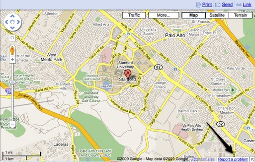
The way Google crowdsources data from users has also been upgraded with the launch of a new tool that lets you communicate directly with Google about any updates that you think need to be made to our maps. On Google Maps, you’ll now notice a “Report A Problem” link to the bottom right of the map where you can easily let Google know if there have been changes to a particular location, destination or roads. Google says that they will confirm suggestions with other users and data sources and will be able to determine the edit within a month.
Previously, you could move map markers on maps and add locations to maps, but this is the first time that Google is deeply engaging user input to make maps more detailed and precise. Google has continuously iterated Maps to make the feature more useful, recently adding more details on traffic conditions. Perhaps Google is gearing Maps up for head-to-head competition from Apple’s new mapmaker.
Interestingly, We’ve heard that Google Maps has ended its partnership with digital map maker TeleAtlas in the U.S., but a spokeswoman for Google says that TeleAtlas continues to provide data in dozens of countries around the world for Google Maps.


They’ve added all the alleys in my neighborhood (in Chicago). And while I know they just want to have every drivable surface mapped, they really aren’t helping anyone by complicating the maps in this way.
This seemingly small change has seriously complicated the map view in ways that actually make the maps more difficult to use.
Does anyone know if or when this level of detail will be available on the iPhone maps?
Hopefully Google will release a full Java API for Google maps someday.
We already have a flash API but for the more serious work most developers turn to something else than html/JavaScript or Flash.
Wow… I was going to use it to report a few errors on google maps that I’ve noticed a while ago (road rerouted years ago, other construction) and every single problem is already fixed, and every missing road added. Simpily amazing.
The report a problem links don’t appear on all Canadian cities on the map. I wonder what the reasoning is for this. don’t they care about all the “problems”?
Whatever they did, it completely messed up the mapping of the Adirondack park… It no longer looks like the largest State park in the US.
You don’t expect it to be actual size do you?
It should be to scale… It looks like they completely chopped it in half if not more. Not only is ths size way off, but the shape is even worse.
I noticed the same thing, and did what Google asked – reported a problem. The size and shape of the Adirondack Park used to be correct before today.
Really, they incredibly messed up the Adirondack Park. This is the largest protected parkland in the lower 48… they need to fix this ASAP. It used to be correct. I can’t even tell what the green blob they include now is SUPPOSED to represent.
Imagine having the same / similar functionality within businesses around process maps or organizational charts, where employees can report suspected problems.
There cannot be any competition to Google maps, the product is just too awesme
Zain – the google maps API sucks compared to Yahoo. Despite what the engineers there told me, they definitely do NOT use the same data for the API as maps.google.com. Yahoo’s geocoding accuracy in the US was about 85% for me vs ~70% for Google’s(up from ~60% 6 months ago). Internationally, yahoo’s much better w/ around 60% to ~40% for Google. Until they get the API right, I have to say Google Maps sucks.
Besides the API, they regularly have the completely wrong location for addresses. Gmaps lied to me 5 times in the last 2 weeks on my blackberry app. If only yahoo had a good mobile app…
Why don’t you fix it?
http://maps.goo...amp;topic=23522
Or at least report it?
http://maps.goo...y?answer=162873
hehe i can see my house
The link doesn’t show for me in Stornoway, Scotland.
Guess I’ll keep arriving at the ferry terminal that doesn’t exist.
I was recently in Munich, and I noticed all the buildings there on google maps were 3d objects. These do not appear in the UK or the US that I know of.
It was quite spooky, as I looked on my phone, it was hovering over what seemed like the 3rd floor apartment that I was in….
where’d they get all the college campus info? USGS doesn’t have that, do they?