
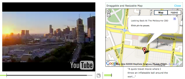
Australian start-up VisualPin allows users to “geocode” their videos by adding a Google Map to each different location in a video, with the map appearing to the side of the video. Here’s one of the best examples on the site.
To be honest, I find the map somewhat distracting from watching the video but I think it could be useful when it comes to documenting travel, news or current events. The technology creates a virtual-location table of contents, allowing the user to click on a marked location to find the corresponding video content.
This appears to be a variation of existing technology that embeds YouTube videos in Google Maps listings. Also Google Maps mashups became particularly useful for news media sites during the inauguration; CNN, Oprah.com and WashingtonPost.com all featured geocoded mashup videos from inaugural events in Washington D.C.
Perhaps NBC’s Today show could use this technology for its next Where in the World is Matt Lauer series.