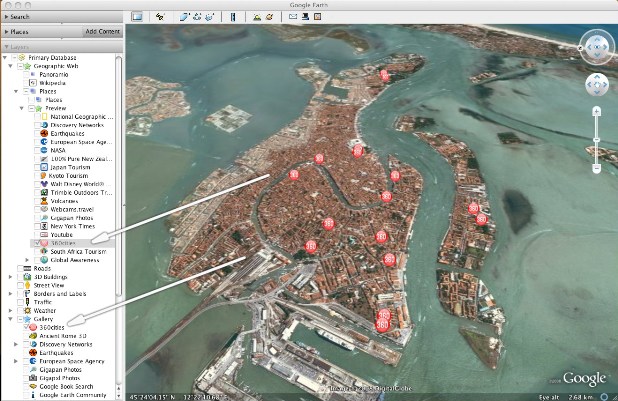
![]() Color me impressed with this one: Prague-based 360 Cities, a network of ‘Virtual Reality’ photographers promoting high-resolution spherical imagery, has integrated its portfolio of stunning 360° panorama shots into the Featured Preview Layer for Google Earth.
Color me impressed with this one: Prague-based 360 Cities, a network of ‘Virtual Reality’ photographers promoting high-resolution spherical imagery, has integrated its portfolio of stunning 360° panorama shots into the Featured Preview Layer for Google Earth.
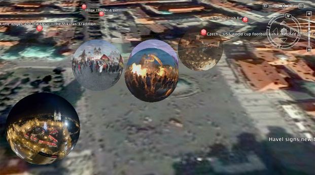
A collection of the panoramas just became visible automatically to every user of the free 3D earth visualization software, and the rest of the 360cities database, which is nearly 10,000 spherical images strong, has been added to the Gallery in Google Earth as well. Some of these are breathtakingly beautiful: check out this shot of the Berlin holocaust memorial, or the inside of this Iranian mosque, or this market place in Gambia, or the Cuban corner bar I embedded below.
http://www.360cities.net/javascripts/krpano/krpano.swf
a Corner Cafe – 2 in Havana
I love seeing people outside of Google doing their best to enhance the Google Earth experience, although it must be said that the company is doing its part too. Recently, they made it possible to visit Ancient Rome in 3D.
Note: this only works with the latest version of Google Earth (4.2), which features the new PhotoOverlay format. You can download the KMZ file here.